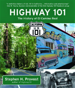
Highway 101: The History of El Camino Real
By Stephen H. Provost
Fresno, Calif.: Craven Street Books, 2020
170 B & W and 33 Color images
248 pp., paperback, $20.95
Reviewed by Barbara Gossett
 Stephen Provost has once again documented the course of a wonderful road trip while providing detailed and entertaining commentary about the history, geography, and (of course) commercial archeology of U.S. Highway 101. His earlier guidebook/history about California State Route 99 blazed a trail in the beautiful world of scenic byways. Highway 101: The History of El Camino Real provides a similar introduction to U.S. 101, the coastal road that follows the path of El Camino Real, the “King’s Highway,” originally a footpath connecting the Spanish missions in Alta California. Franciscan missionaries had established the string of missions in the late 18th century that were spaced to be a day’s walk apart, providing a resting place for pilgrims on their journey.
We are introduced to the road and its rise to stardom in the world of cultural icons some 100 years after it was created, mainly by the work of boosters. These included Harrie Forbes, who dedicated herself to re-introducing the trail by installing mission bells along the alignment. Not surprisingly, Harrie and her husband were owners/operators of the only bell foundry in California at the time. The increasing popularity of the automobile led to the trail becoming a proper highway, paved and well-marked.
Provost highlights some salient features of its history before embarking on a region-by-region tour of the road and its environs. The bells that have become synonymous with U.S. 101 are the first thing we see, although these days, you have to look sharp to find them. The road also guided Dust Bowl refugees to camps, which are described in vivid, sometimes depressing, detail. We’re introduced to New Deal photographer Dorothea Lange and her most iconic image, the “migrant mother” Florence Owens Thompson. Provost provides the back story to their working relationship, and how Thompson’s life progressed after her brush with fame.
To the joy of commercial archeology enthusiasts, Provost has dedicated chapters to motels/hotels/motor courts, complete with a clear definition of what distinguishes these types of overnight accommodations. Restaurants and diners, and miscellaneous attractions are also covered, including a lot of neon. Black and white photos, current and vintage, accompany the topics. In the mid-point of the book is an entire chapter of U.S. 101 in color, divided into categories: the sights, including the road itself, buildings of interest, and neon. Provost photographed the color and many of the black and white images and has credited sources for the others.
With this comprehensive introduction to U.S. 101, we begin following its trail. Our journey starts at the southern end of the road, in north San Diego County. We find that the numbered federal highway has many local names, which can prove confusing to newcomers, sometimes even to Southern Californians who are unfamiliar with regions other than their neighborhood.
It’s the “Carlsbad Highway” in north San Diego County, although it begins at the Mexican border and extends to Oceanside, north of Carlsbad. In Orange County, it’s called the Santa Ana Freeway, now designated Interstate 5. Interestingly, this is the only stretch of the coastal highway where U.S. 101 formally does not exist. In its heyday, there were two highways in the 1940s and 1950s: U.S. 101 and U.S. 101 Alternate. The latter followed today’s I-5, while the former traveled through the “Beach” cities: Laguna, Newport, Huntington, Seal, Long, and north to Redondo. Such richness of detail about a highway’s early incarnations may be of more interest to locals, but it’s an absorbing view of how roads morph from trails to superhighways.
Traveling north, the Hollywood Freeway and Ventura Freeway, both through communities for which they’re named, are followed by the Cabrillo Highway through Santa Barbara County. Next are the Salinas Valley Road through Steinbeck country, Pacific Coast Highway through Big Sur and Carmel, the Bayshore Highway through San Francisco, and the Redwood Highway north to the Oregon border. The stories and images that chronicle “the 101” (its name in traffic reports) are fascinating. Even if you live in the shadow of the road, you will find something in Provost’s narrative that you didn’t know, or if you did, you’ll get the full back story.
Like for its predecessor on Route 99, I strongly recommend Highway 101: The History of El Camino Real. Whether you’re a fan of history or an enthusiast of quirky sights along the way, you’ll savor the virtual road trip.
Barbara Gossett is a retired regional transportation planner living in Southern California. Besides commercial archeology, her interests are cycling, gardening, and hanging out with family.
This book review originally appeared in the SCA Journal, Spring 2021, Vol. 39, No. 1. The SCA Journal is a semi-annual publication and a member benefit of the Society for Commercial Archeology.
More Book Reviews


